Main Flight
The Main Flight was launched on March 17 2012 at 11:23. The date was chosen because forecasts indicated that it was the best weather that we would get for a while. The weather conditions were fair in the morning, -3°C and moderate winds. As the launch preparations progressed the wind increased considerably.
Trajectory
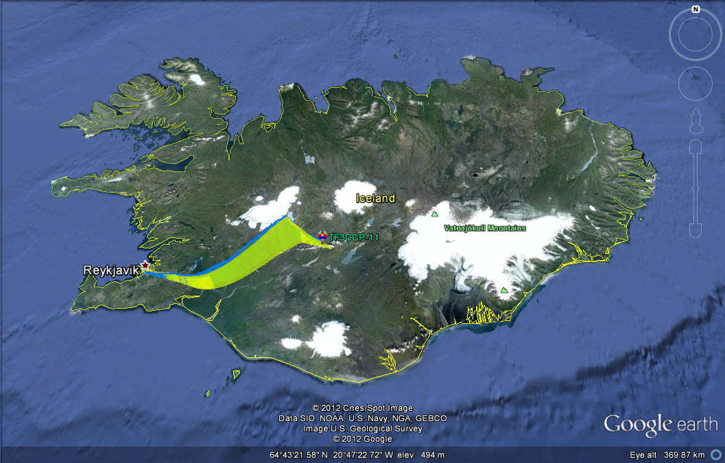
For our previous flight we'd used the University of Wyoming Balloon Trajectory Forecast. After meeting with one of the team members from from the HABIceland balloon team we switched over to the HABHUB trajectory forecast. HABHUB's interface is much more user friendly than that of the University of Wyoming's model. Another feature is that you can adapt the model to incorporate different ascent and descent speeds.
For our previous flight we'd used the University of Wyoming Balloon Trajectory Forecast. After meeting with one of the team members from from the HABIceland balloon team we switched over to the HABHUB trajectory forecast. HABHUB's interface is much more user friendly than that of the University of Wyoming's model. Another feature is that you can adapt the model to incorporate different ascent and descent speeds.
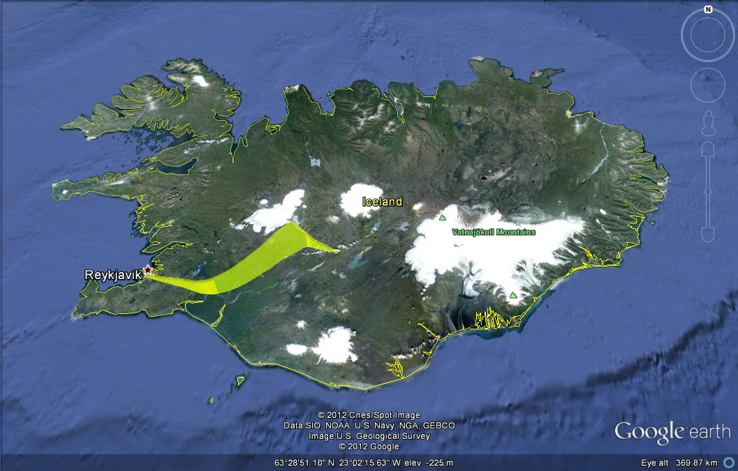
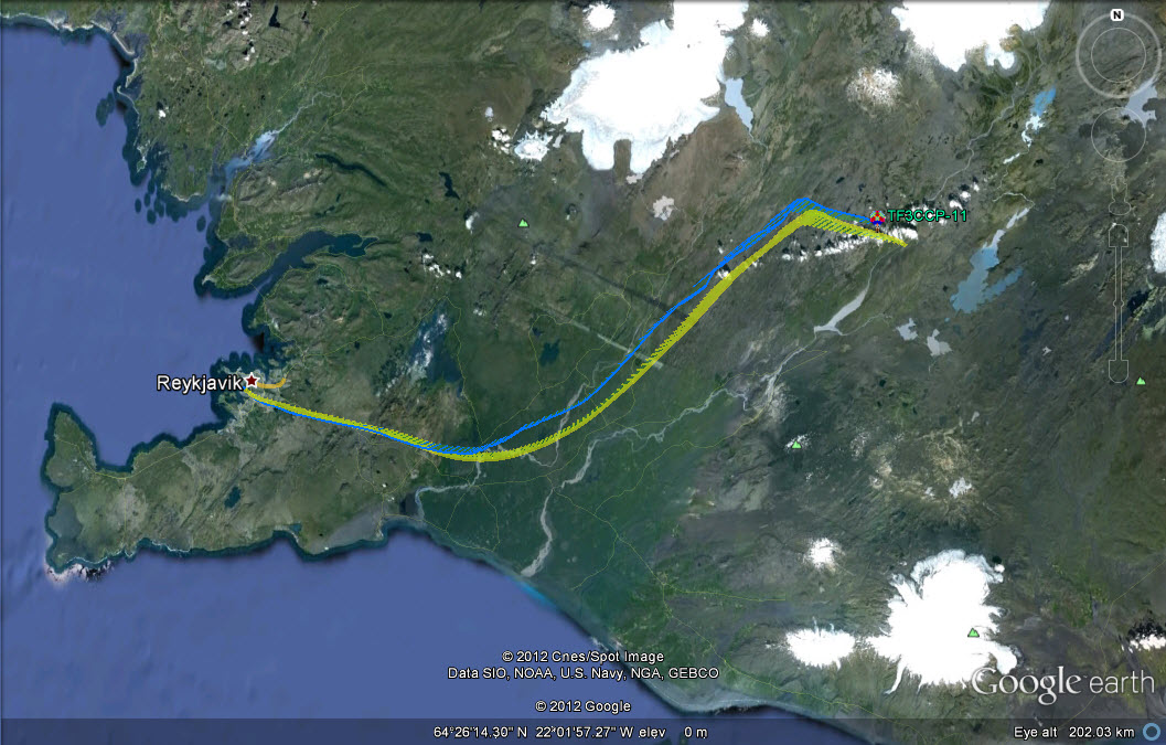
Main flight predicted trajectory.
Authorization
Because of our experience with the approval process of our application for authorization for the test flight we applied well in advance for authorization for the main flight. The review process this time a round was much shorter and we had the authorization letter in hand well before the actual launch date. As before the terms of the permit were to abide by the local flight regulation and call up the air traffic control tower for final clearence before the launch.
Because of our experience with the approval process of our application for authorization for the test flight we applied well in advance for authorization for the main flight. The review process this time a round was much shorter and we had the authorization letter in hand well before the actual launch date. As before the terms of the permit were to abide by the local flight regulation and call up the air traffic control tower for final clearence before the launch.
Payload
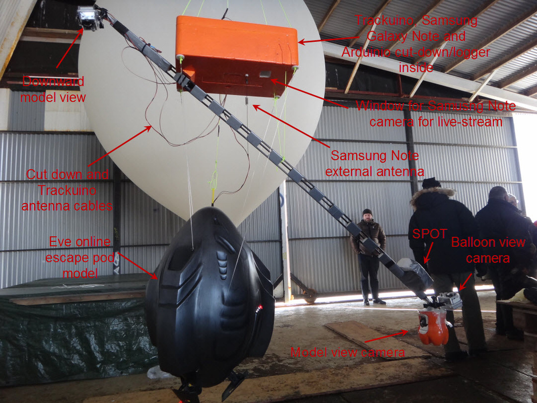
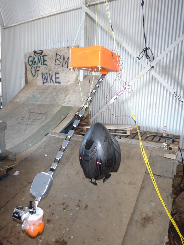
As this was a full scale launch, it had all the equipment and the model on board. As in the test flight a styrofoam box was used to house the delicate electronics (Trackuino, Samsung Galaxy Note and Arduino board for cut-down and logging). A boom was constructed from CNC milled styrofoam and fiber reinforced plastic rods to carry the GOPRO cameras in the desired locations. The camera's were angled to view the model laterally from the front, angled down on the model from the top and one camera capturing the balloon itself in an upward direction. Due to the SPOT interfearing with the Trackuino, the SPOT was moved to a location on the camera boom.
As this was a full scale launch, it had all the equipment and the model on board. As in the test flight a styrofoam box was used to house the delicate electronics (Trackuino, Samsung Galaxy Note and Arduino board for cut-down and logging). A boom was constructed from CNC milled styrofoam and fiber reinforced plastic rods to carry the GOPRO cameras in the desired locations. The camera's were angled to view the model laterally from the front, angled down on the model from the top and one camera capturing the balloon itself in an upward direction. Due to the SPOT interfearing with the Trackuino, the SPOT was moved to a location on the camera boom.
Payload
|
Payload
|
Payload
|
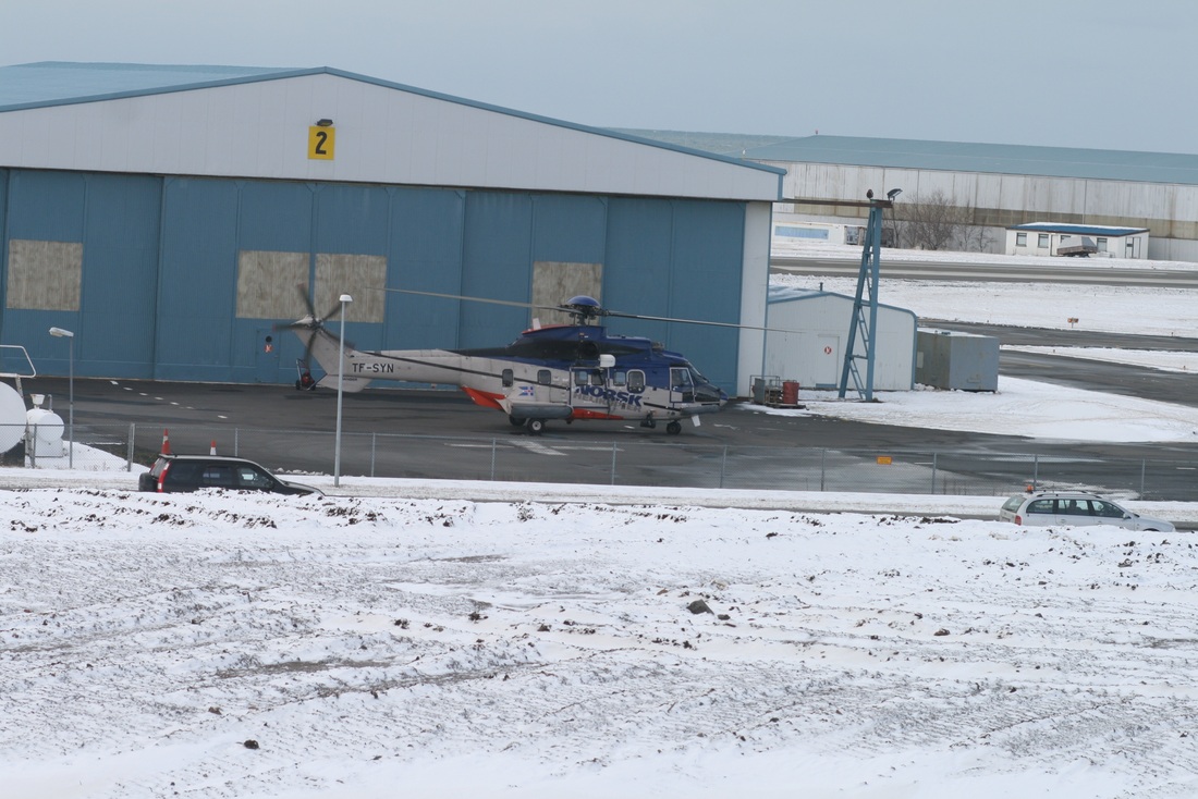
Launch preperation
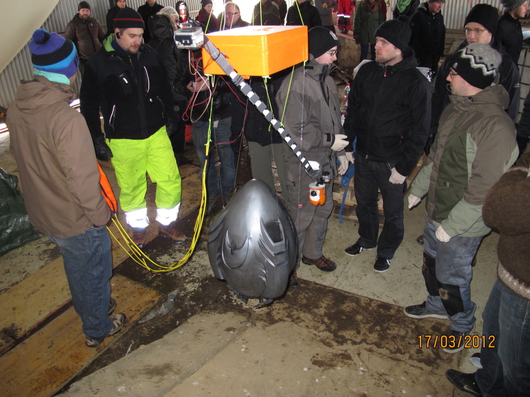
Due to confusion in the test flight's preperation check lists were made for all steps in the procudure. From what equipment to bring to the hangar to how the ballon was filled and the payload attached. This time around filling and payload assembly wen't smoother than in the previous launch
Due to confusion in the test flight's preperation check lists were made for all steps in the procudure. From what equipment to bring to the hangar to how the ballon was filled and the payload attached. This time around filling and payload assembly wen't smoother than in the previous launch

One of many checklists
|
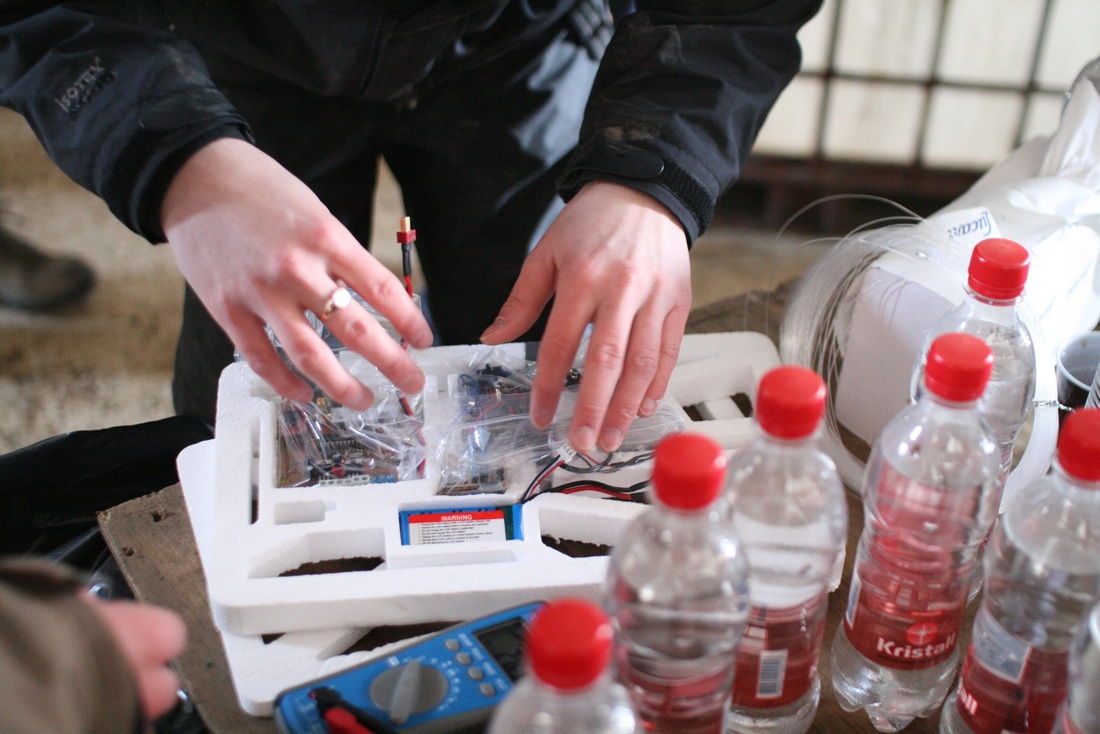
Payload electronics being assembled, styrofoam insert contains Trackuino and Arduino logger/cut-down
|
Launch
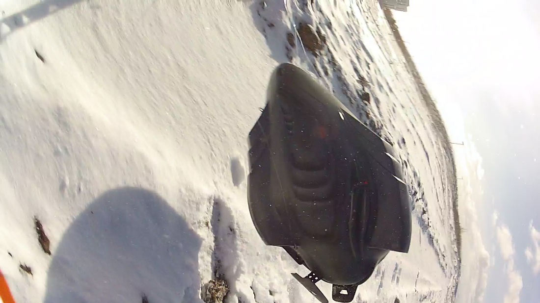
When the balloon and payload were ready and we'd been cleared with air traffic control at Reykjavík Airport the balloon was released from its tether to the filling table, the hangar doors were opened and the balloon was brought outside. At this point the wind had increased considerably and upon exciting the hangar the balloon was pushed to the ground. As we needed to take the slack off the line tethering the equipment to the balloon we were forced to run with the balloon across rough ground. At the point of release the balloons height was insufficient to properly suspend the payload and it hit the ground, snapping the camera boom, banging the cameras off axis and tangling the lines suspending the model. The balloon and payload took off, but it was obvious that there was considerable damage to the payload and we might not get useful video from the flight. Another consequence of the crash is that the Samsung Galaxy Note was banged loose of it's milled seat and the live stream showed only the inside of the styrofoam box. The crash also disconnected the phone from it's external antenna, despite of this the phone stayed in coverage for the whole duration of the flight to an altitude of 34km.
When the balloon and payload were ready and we'd been cleared with air traffic control at Reykjavík Airport the balloon was released from its tether to the filling table, the hangar doors were opened and the balloon was brought outside. At this point the wind had increased considerably and upon exciting the hangar the balloon was pushed to the ground. As we needed to take the slack off the line tethering the equipment to the balloon we were forced to run with the balloon across rough ground. At the point of release the balloons height was insufficient to properly suspend the payload and it hit the ground, snapping the camera boom, banging the cameras off axis and tangling the lines suspending the model. The balloon and payload took off, but it was obvious that there was considerable damage to the payload and we might not get useful video from the flight. Another consequence of the crash is that the Samsung Galaxy Note was banged loose of it's milled seat and the live stream showed only the inside of the styrofoam box. The crash also disconnected the phone from it's external antenna, despite of this the phone stayed in coverage for the whole duration of the flight to an altitude of 34km.
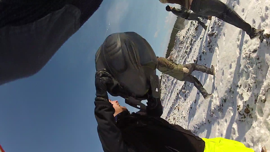
Running after the balloon over rough terrain
|
Payload impacting with the ground
|

Balloon and payload airboourne, damage visible
|
Tracking
With three trackers onboard we were sure that we would be able to track the balloon, and we sure were able to inspite of the crash during the launch. The Samsung Note, the SPOT and the Trackuino all performed as planned, and in the case of the Samsung and the Trackuino well beyond expectation. The Samsung Note transmitted location data for almost the entire trip, it only stopped shortly before impact, when it lost the line of sight to the cell tower. The SPOT performed similarly to the previous flight. It cut out at an altitude of around 11km and reappeared once it was on the ground. It however performed the task of providing the retrieval coordinates well. The Trackuino was a total surprise. It performed admirably with almost zero dropout. A lot of time was spent on the Trackuino build, but none of it was wasted. The aprs.fi provides you with a live updated Google Earth .kmz file that is very exciting to watch. The balloon burst at 12:55
With three trackers onboard we were sure that we would be able to track the balloon, and we sure were able to inspite of the crash during the launch. The Samsung Note, the SPOT and the Trackuino all performed as planned, and in the case of the Samsung and the Trackuino well beyond expectation. The Samsung Note transmitted location data for almost the entire trip, it only stopped shortly before impact, when it lost the line of sight to the cell tower. The SPOT performed similarly to the previous flight. It cut out at an altitude of around 11km and reappeared once it was on the ground. It however performed the task of providing the retrieval coordinates well. The Trackuino was a total surprise. It performed admirably with almost zero dropout. A lot of time was spent on the Trackuino build, but none of it was wasted. The aprs.fi provides you with a live updated Google Earth .kmz file that is very exciting to watch. The balloon burst at 12:55
APRS track (blue) and trajectory prediction (yellow)
|
|
Landing
The payload landed at 13:17 in the Icelandic highlands. Near the Sultartangi hydroelectric power station. As agreed upon a helicopter from the Icelandic Coast Guard was spooling up for a combined search and rescue exercise and retrieval mission, along for the ride was a team member Þórður Sigurbjartsson and a CCP camera crew. The helicopter and it's crew never found they payload in spite of accurate location data. Later we discovered that we experienced similar problems as our space faring collegues at NASA, the data from the SPOT was in the decimal coordinate system. The Coast Guards crew mistook this for conventional deg-min-sec coordinates and ended up searching in the wrong location for over an hour.
The payload landed at 13:17 in the Icelandic highlands. Near the Sultartangi hydroelectric power station. As agreed upon a helicopter from the Icelandic Coast Guard was spooling up for a combined search and rescue exercise and retrieval mission, along for the ride was a team member Þórður Sigurbjartsson and a CCP camera crew. The helicopter and it's crew never found they payload in spite of accurate location data. Later we discovered that we experienced similar problems as our space faring collegues at NASA, the data from the SPOT was in the decimal coordinate system. The Coast Guards crew mistook this for conventional deg-min-sec coordinates and ended up searching in the wrong location for over an hour.
Coast Guard helicopter spooling up
|
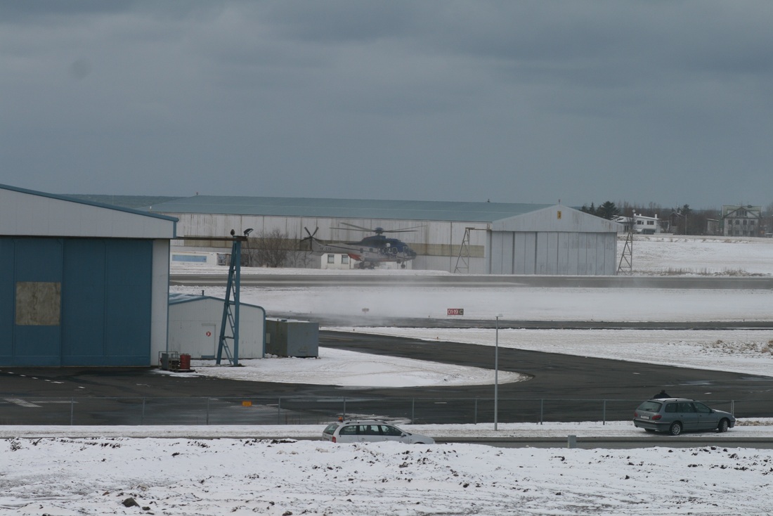
Coast Guard helicopter taking off
|
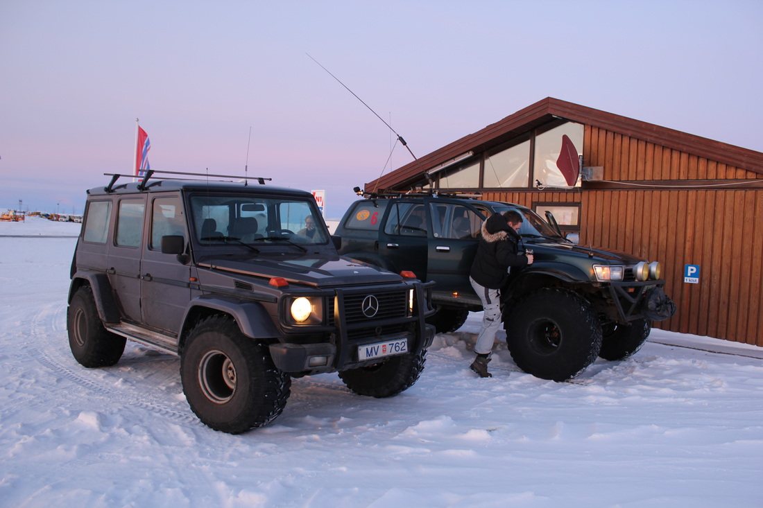
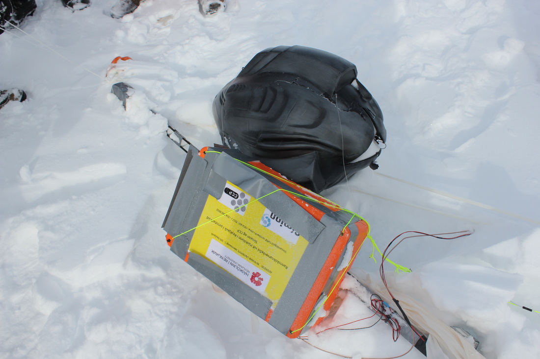
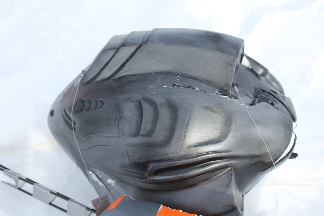
Recovery
Once it became clear that the helicopter mission was a failure, groundwork was lain for a 2 car retrieval mission by 4x4. A member of the team and a member of the support crew had a superjeep each. The mission was planned and provisioned during the remainder of the day and early next morning 8 people in two cars headed out for the Icelandic highlands. At this time of year there is quite a lot of snow in the highlands so the trip lasted 14 hours but only covered a distance of around 350km for the round trip. As with most highland trips in the winter there was some excitement and brake downs, mid trip a drive shaft in one of the vehicles had to be fixed. The mission was a success, the entire payload was retrieved, during the landing the space ship model cracked open, besides that there was no additional damage sustained by the payload, all the electronics survived and will be flown on the final flight.
Once it became clear that the helicopter mission was a failure, groundwork was lain for a 2 car retrieval mission by 4x4. A member of the team and a member of the support crew had a superjeep each. The mission was planned and provisioned during the remainder of the day and early next morning 8 people in two cars headed out for the Icelandic highlands. At this time of year there is quite a lot of snow in the highlands so the trip lasted 14 hours but only covered a distance of around 350km for the round trip. As with most highland trips in the winter there was some excitement and brake downs, mid trip a drive shaft in one of the vehicles had to be fixed. The mission was a success, the entire payload was retrieved, during the landing the space ship model cracked open, besides that there was no additional damage sustained by the payload, all the electronics survived and will be flown on the final flight.

|

|

|
