Trackuino
The Trackuino project is community project run by high altitude balloon enthusiasts. The Trackuino is an APRS tracker for the Arduino/Atmega328p platform. The Trackuino comes in two flavors. As a shield for an off the shelf Arduino board or as a custom double sided PCB. The custom board saves a little on weight as it reduces the amount of components that are not necessary
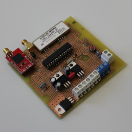
Assembled Trackuino
The main features according to the Trackuino website are:
As we had a separate device to log temperature and pressure as well as performing the cut down of the balloon we did not use these features of the Trackuino. We opted for the Radiometrix HX1 transmitter for our build. The main reason for this was the reduced part count for simplicity.
The Trackuino was handbuilt at RU's electronic lab with assistance from Hrannar Traustason the lab's supervisor. The Trackuino PCB was printed in house using photoresist etching. The Trackuino performed impeccably.
- GPS: Venus 634FLPx. Reports okay above 18 Km.
- Radio: The board supports Radiometrix's HX1 (300 mW) as well as Argentdata's MX146-8v (500 mw).
- 1200 bauds AFSK using 8-bit PWM
- Sends out standard APRS position messages (latitude, longitude, altitude, course, speed and time).
- Internal/external temperature sensors (LM60) to read temperature in and outside the payload
- Support for 1 capacitive humidity sensor
- Cut-down aka "suicide" mechanism: you can hook up a nicrom wire and cut the payload line if your balloon gets stuck aloft for a long time.
- ICSP header for in-circuit programming
- 2 x SMA female plugs (1 x GPS in + 1 x radio out)
- Open source (GPLv2 license), both software and hardware. In other words, do whatever you want with it: modify it, add it to your project, etc. as long as you opensource your modifications as well.
As we had a separate device to log temperature and pressure as well as performing the cut down of the balloon we did not use these features of the Trackuino. We opted for the Radiometrix HX1 transmitter for our build. The main reason for this was the reduced part count for simplicity.
The Trackuino was handbuilt at RU's electronic lab with assistance from Hrannar Traustason the lab's supervisor. The Trackuino PCB was printed in house using photoresist etching. The Trackuino performed impeccably.
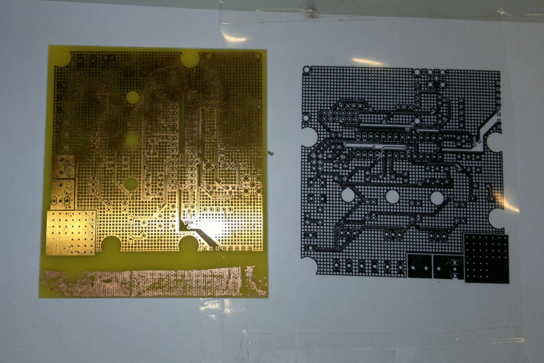
Trackuino PCB with photoresist mask
|
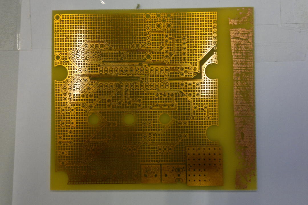
Trackuino PCB
|
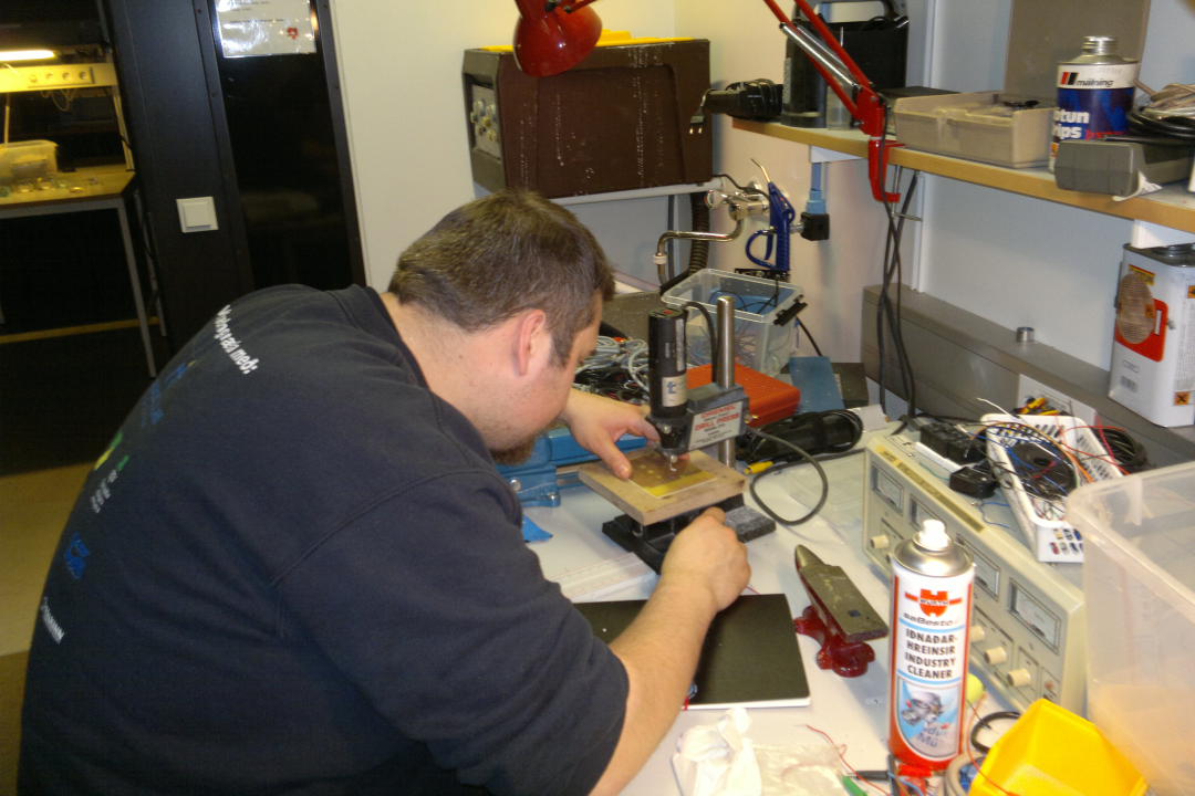
Drilling the PCB for the components
|
Trackuino antenna
After we finished building the Trackuino, we needed two antennas. One for the GPS module and another for transmitting APRS data down to earth. The antenna for the GPS module was standard active GPS button antenna.
We had to build the antenna used to transmit APRS data packages, this antenna was connected to the VHF transmitter on the trackuino. We decided to use dipole antenna made from coaxial cable, the other solution was to make a dipole from a wire and a conductive plate. The plate was supposed to be under the foam box, but that causes to many problems, e.g. covering phone lens, and the wire would be in front of GoPro's viewpoint, plus the factor of the added weight of the plate.
The length of the antenna is approximately 1m. When we had designed and build the antenna, was the next problem to find a good place for it. First idea was to put it on the boom, and after fastening the antenna on the boom we discovered a problem when we measured the standing wave ratio (SWR) we found out that almost all the sending power was reflecting to the Radiometrix transmitter, that means that no power goes to send the APRS package down to earth. Obviously this wasn't going to work and we needed another solution. Next idea was to move the antenna up into the tether between the parachute and the equipment box. Again we mesured the standing wave and it looked better, but the wire for the cut down disturbed the standing wave. The final solution was to have the antenna there, and simply fasten the coax cable from the antenna and the cut down wire to the upper end of the boom, and from there we lay the wire into the box.

Trackuino antenna
SPOT
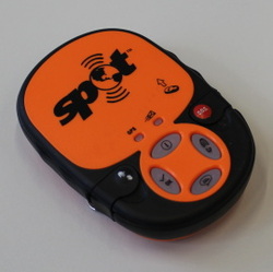
SPOT
The SPOT is a popuplar solution to the problem of pinpointing the landing site of the payload once the balloon bursts. The SPOT is marketed as an emergency GPS beacon for hikers. The SPOT has the ability to report its position once every ten minutes to the official SPOT website for 24h when a button on the device is pressed this makes it unpractical for real time tracking. The spot has been used extensively by HAB enthusiast. In our case the SPOT was used to pinpoint the landing site due to the fact that the Trackuino and Samsung would be out of contact at the langind site.
Samsung Galaxy Note
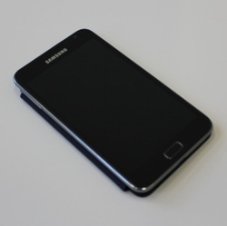
Samsung Galaxy Note
The Samsung Galaxy Note Android phone has an integrated GPS reciever. This allowed us to use an Android program called Instamapper to log the GPS track of the balloons flight to the internet.
The Samsung was provided by our partner, Síminn. The phone was set to operate on a part of the 3G spectrum not currently in use. In order to enable us to use this part of the spectrum a 3G cell was installed on one of Síminn's cell tower near Öskjuhlíð in Reykjavík. The balloon's Samsung is the only phone using this cell.
The Samsung was provided by our partner, Síminn. The phone was set to operate on a part of the 3G spectrum not currently in use. In order to enable us to use this part of the spectrum a 3G cell was installed on one of Síminn's cell tower near Öskjuhlíð in Reykjavík. The balloon's Samsung is the only phone using this cell.
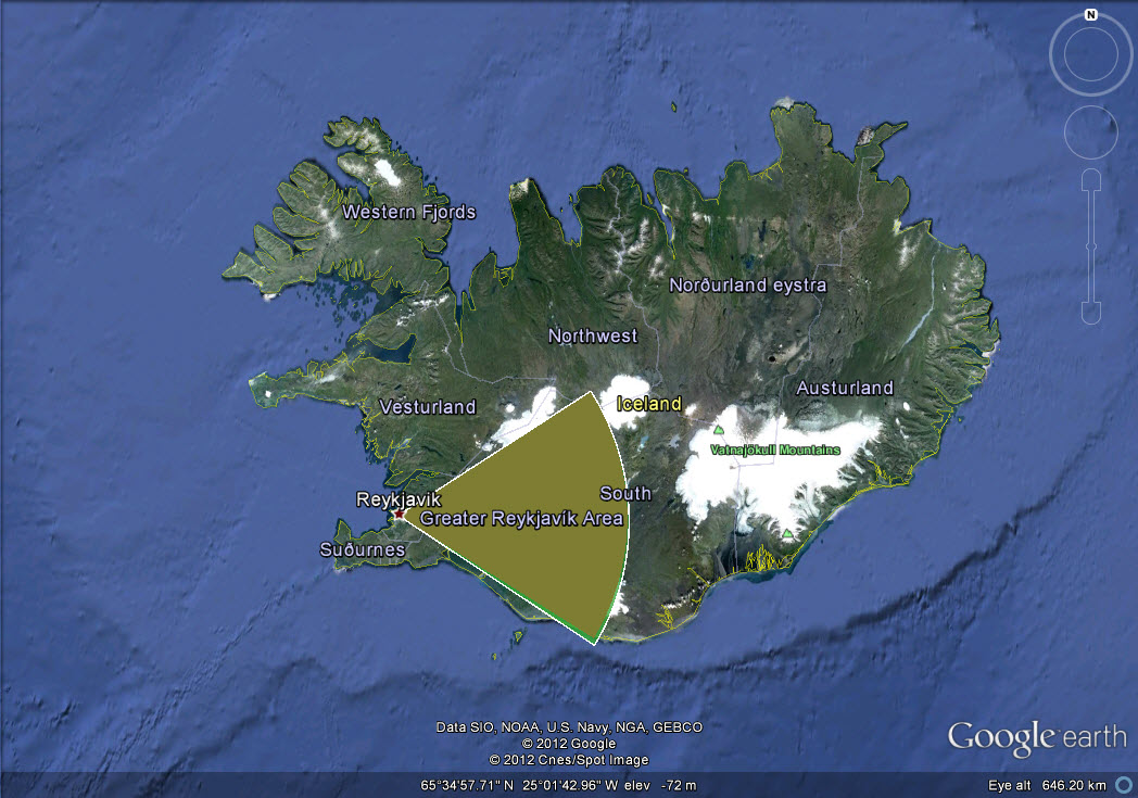
The approximate coverage of the 3G cell
|

The 3G cell was added to this tower in Öskjuhlíð, Reykjavík
|
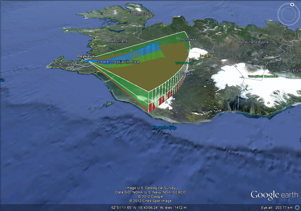
Main flight trajectory displayed within the cell's 3G coverage
|
